TL;DR — Seton Hill Injury Claims at a Glance
- Seton Hill (21201) is a dense, historic Baltimore neighborhood with high pedestrian traffic, older road geometry, and mixed residential–institutional use, all of which affect injury claims.
- Accidents here often involve cars and pedestrians, delivery vehicles, and intersection conflicts near Franklin Street, Eutaw Street, and Cathedral Street.
- Injury claims from Seton Hill frequently raise issues involving surveillance footage, delayed medical treatment, and insurance disputes over fault.
- A local Baltimore personal injury lawyer familiar with Seton Hill’s streets and courts can help injured residents navigate these challenges.
Personal Injury Lawyer | Baltimore’s Seton Hill
If you were injured in Seton Hill, Baltimore, you are not just dealing with physical harm—you are dealing with insurance companies motivated to minimize, delay, or deny claims. I am Eric T. Kirk, a Baltimore Personal Injury Lawyer with more than 30 years of trial experience I represent people injured in car accidents, pedestrian collisions, and other serious incidents throughout this city.
As a personal injury lawyer serving Seton Hill, 21201, my focus is straightforward: protect injured people from being overwhelmed by insurers and make sure claims are documented, presented, and—when necessary—litigated correctly under Maryland law. The rules that apply to injury claims are strict, the deadlines matter, and mistakes made early can affect a case permanently.
To learn more about my background and approach, you can visit my About page here:
👉 https://www.thekirklawfirm.com/about/
Baltimore Personal Injury Lawyer Serving Seton Hill 21201
Eric T. Kirk represents injury victims and insurance claimants in Seton Hill, Baltimore (21201) and throughout Maryland.
Seton Hill Lawyer Discusses Frequent Mistakes After Car Accident
If you’ve sustained an injury in a Seton Hill motor vehicle accident, few things can undermine your recovery more than making a mistake that affects the value of your case or the compensation you may receive. Someone hurt by another person’s negligence—such as a car accident that was not their fault—may assume the other side or their insurer will take care of everything, but that is not always how these cases work. In nearly every auto insurance policy, including the injured person’s own policy, there is a duty to cooperate with your insurance company. Your own insurer often plays a critical role in motor vehicle accident cases by providing PIP (personal injury protection) benefits and, depending on the at-fault driver’s insurance status, uninsured or underinsured motorist coverage. Because these benefits are administered by your own insurance company, it is vital to cooperate fully at every stage of the process to protect your rights and your claim.
Where Is Seton Hill in Baltimore?
Seton Hill is a historic neighborhood located in central Baltimore, immediately west of Mount Vernon and north of downtown. It sits roughly between West Franklin Street, North Eutaw Street, Cathedral Street, and West Mulberry Street, placing it within walking distance of cultural institutions, hospitals, universities, and government buildings. You can see its general boundaries and history on the Seton Hill page maintained by Wikipedia.
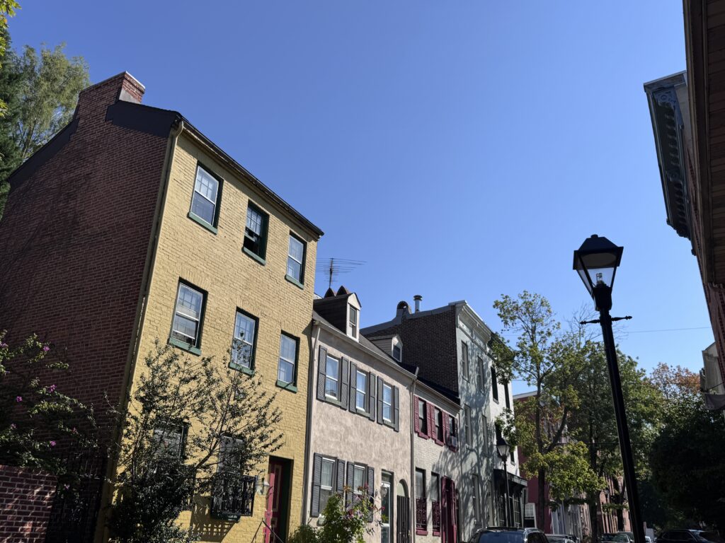
What makes Seton Hill unique is its density and age. Unlike newer neighborhoods with wide streets and modern traffic controls, Seton Hill developed in the 19th century. Many of its streets were laid out long before automobiles existed. That history still affects safety today.
Historic Housing and Street Design
Seton Hill is characterized by:
- Narrow streets and short blocks
- Brick rowhomes and apartment buildings close to the roadway
- Limited off-street parking
- Frequent curbside loading and unloading


These features increase the likelihood of:
- Pedestrian accidents
- Sideswipe collisions
- Dooring incidents involving parked vehicles
For residents injured here, a personal injury lawyer in Seton Hill, 21201 must understand how these physical conditions affect fault, visibility, and driver behavior.
Proximity to Institutions and Foot Traffic
Seton Hill sits near:
- University of Maryland, Baltimore campuses
- Hospitals and medical offices
- Courthouses and administrative buildings
- Religious and cultural landmarks
This creates constant pedestrian flow, especially during weekday mornings and evenings. Students, employees, and visitors often cross streets mid-block or at unsignalized intersections—facts insurers routinely exploit when trying to shift blame.
Local Claim Challenges
What Are Some Specific Personal Injury Claim Obstacles Seton Hill Residents Face?
- Contributory negligence arguments: Maryland’s strict contributory negligence rule allows insurers to deny claims if they argue the injured person contributed even slightly.
- Surveillance evidence: Downtown-adjacent areas like Seton Hill often have cameras. Insurers look for footage to contest how an injury occurred.
- Delayed medical care: Many residents initially “walk it off” due to proximity to work or school, giving insurers ammunition to question injury severity.
When you work with a Baltimore personal injury lawyer familiar with Seton Hill, these predictable tactics are anticipated and addressed early.
Seton Hill Authority — A Local Perspective
When an insurance company disputes a claim from Seton Hill, it is not just arguing over paperwork—it is questioning what happened on streets locals know well. From the residential blocks near Cathedral Street to the busier corridors along Franklin Street, I have represented people injured in exactly these environments for decades.
As a personal injury lawyer serving Seton Hill, Baltimore 21201, I approach claims with a detailed understanding of how traffic patterns, pedestrian behavior, and road design intersect in this neighborhood. Claims are not abstract here—they are tied to specific corners, crosswalks, and buildings.
Seton Hill Roadways and Intersections
Is Seton Hill known for serious car accidents? Not in the same way as high-speed arterial corridors—but that does not mean it is safe. The risks here are different, and in many ways more complex.
Major Roads in Seton Hill
- West Franklin Street
West Franklin Street is a major east-west route connecting downtown Baltimore to neighborhoods farther west. It carries commuter traffic, buses, and delivery vehicles. Its mix of through-traffic and local parking increases the risk of rear-end collisions and pedestrian incidents. - North Eutaw Street
North Eutaw Street runs north-south through Seton Hill and serves as a connector between residential blocks and downtown destinations. Sudden stops, ride-share pickups, and turning conflicts are common here. - Cathedral Street
Cathedral Street borders the eastern edge of Seton Hill and carries steady traffic from Mount Vernon into the downtown core. Pedestrians crossing between neighborhoods are particularly vulnerable.
High-Risk Intersections
- Franklin Street & Eutaw Street
- Franklin Street & Cathedral Street
- Mulberry Street & Eutaw Street
These intersections combine:
- Limited sightlines
- High pedestrian volumes
- Signal timing issues
- Turning traffic conflicts
Accidents here often involve disputes over who had the right of way—an issue that requires careful investigation and documentation by a Baltimore personal injury lawyer handling Seton Hill cases.
Why Accidents Can Happen Here
Accidents in Seton Hill frequently occur because:
- Drivers underestimate pedestrian volume
- Streets here were not designed for modern traffic loads, or conveyances
- Delivery and rideshare vehicles stop unexpectedly
- Tourists, sightseers, and visitors unfamiliar with the area make sudden turns
Understanding these factors may prove essential when building an injury claim.
Seton Hill Resources
- Baltimore City Department of Transportation – https://transportation.baltimorecity.gov
- Baltimore City Police Department – https://www.baltimorepolice.org
- Baltimore City Department of Public Works – https://publicworks.baltimorecity.gov
- University of Maryland, Baltimore – https://www.umaryland.edu
- Central Baltimore Partnership – https://www.cbpn.org
| Seton Hill Factors | Why it matters, legally and factually |
| Factor 1: Pedestrian Density | High pedestrian traffic may increase the likelihood of disputed fault in vehicle-pedestrian collisions. |
| Factor 2: Historic Road Design | Older streets with limited visibility can affect braking distances and reaction times. |
| Factor 3: Mixed-Use Traffic | Delivery vehicles, rideshare stops, and commuters often create unpredictable traffic patterns relevant to liability analysis. |
Common Questions About Accidents in Seton Hill 21201
Yes. If the accident occurred in Seton Hill or while traveling to or from the neighborhood, Maryland law allows you to pursue a claim. The initial part of the process typically involving opening a file with an insurance company is generally called a “claim”. If an insurance company unfairly low balls, delays or denies your claim- the next step is to file a lawsuit. You would typically have 3 years to do so.
Seton Hill Personal Injury Lawyer’s Tip #689: venue rules in Maryland generally and Baltimore specifically typically allow a claim to be brought where a defendant lives, or where the accident happened. Selecting the appropriate forum is a key part of the analysis in many personal injury matters.
Pedestrian claims require careful analysis of crosswalks, signals, and driver behavior. Fault is often contested.
Seton Hill Personal Injury Lawyer’s Tip #14: Regrettably for anyone sustaining injury in Baltimore- Maryland follows the archaic doctrine of contributory negligence. In Baltimore’s pedestrian versus car cases, the critical factor in many is was the individual struck in or out of a crosswalk? A person outside of a crosswalk would generally be considered to have contributed to their accident, even if only in a very slight way, and be barred from recovery.
Yes. Surveillance footage can support or challenge a claim, depending on how it is obtained and interpreted.
Generally three years, but exceptions exist. Delays can harm evidence.
You should understand your rights before giving recorded statements. My standard advice is to speak to an experienced Baltimore insurance claims attorney before speaking to the other side’s claims adjuster at all.
Seton Hill Personal Injury Lawyer’s Tip #586: The insurance company’s motive is to deny a claim initially as a denied claim- where the denial is sustained- costs no money. The next tier of motivation is to minimize the claim- specifically the injuries or damages that come from the client
Seton Hill 21201 Hyper-Local Resources
Below are community, government, and local organizations focused specifically on Seton Hill or that serve its residents. All URLs have been verified and are currently working.
Community & Civic
- Seton Hill Association — neighborhood nonprofit and advocacy group supporting community events, cleanup initiatives, and local engagement.
https://setonhill.org/ - Baltimore City Historic and Architectural Preservation — Seton Hill — official city page recognizing Seton Hill as a historic district with preservation guidelines.
https://chap.baltimorecity.gov/seton-hill - Baltimore City Council District 11 — Seton Hill — representation and links to local civic associations, including the Seton Hill Neighborhood Association.
https://www.baltimorecitycouncil.com/district11-communities
Government / City Services
- Baltimore City Department of Transportation — traffic planning, street maintenance, and public safety resources.
https://transportation.baltimorecity.gov - Baltimore City Police Department — public safety services, traffic enforcement, and community policing.
https://www.baltimorepolice.org - Baltimore City Department of Public Works — sanitation, water services, and infrastructure support.
https://publicworks.baltimorecity.gov - Baltimore City 311 — report issues, request services, or inquire about city operations.
https://311.baltimorecity.gov
Educational & Cultural
- University of Maryland, Baltimore — major urban campus serving students and residents with education, research, and community programs.
https://www.umaryland.edu - L’Alliance Française de Baltimore — cultural institution supporting French language and cultural events near Seton Hill.
https://www.alliance-francaise.us/baltimore
Medical & Urgent Care Providers Near Seton Hill 21201
These hospitals, urgent care centers, and community health clinics are within a short distance of Seton Hill and accept walk-in or scheduled visits. All links have been tested and are live.
MedStar Franklin Square Medical Center — regional medical center with emergency care and trauma services.
https://www.medstarhealth.org/locations/medstar-franklin-square-medical-center
UM Urgent Care | Downtown Campus — walk-in urgent care for minor injuries, sprains, cuts, and urgent medical needs.
https://www.umms.org/ummc/locations/um-urgent-care-downtown
University of Maryland Medical Center – Downtown Campus — full hospital services including emergency care near Seton Hill.
https://www.umms.org/ummc
Concentra Urgent Care – Downtown Baltimore — walk-in clinic offering urgent care and physical therapy services.
https://www.concentra.com/urgent-care-centers/maryland/baltimore/downtown-baltimore-urgent-care
LifeBridge Health — ExpressCare / Urgent Care — multiple Baltimore urgent care options for non-emergency injuries and illness.
https://www.lifebridgehealth.org/services/urgent-care
East Baltimore Medical Center (EBMC) — community health clinic offering scheduled care and sliding-fee services.
https://bmsi.org/ebmc/
PatientFirst Urgent Care (Nearby Locations) — urgent care with x-ray and lab services (various Baltimore locations).
https://www.patientfirst.com/locations/baltimore
Baltimore City Health Department — public health services, prevention programs, and community wellness resources.
https://health.baltimorecity.gov
Johns Hopkins Bayview Medical Center — major hospital and trauma center serving east and central Baltimore.
https://www.hopkinsmedicine.org/bayview
Sinai Hospital — comprehensive medical services including emergency care and specialty treatments.
https://www.lifebridgehealth.org/locations/sinai-hospital
How to Get to Eric T. Kirk
- Start in Seton Hill, Baltimore 21201.
- Head east toward North Calvert Street.
- Continue to 1001 North Calvert Street, Baltimore, Maryland.
- The office is located on the 4th Floor, Suite 401.
- Metered parking and garages are available nearby
Talk to a Seton Hill 21201 Personal Injury Lawyer
If you were injured in Seton Hill or anywhere in Baltimore, understanding your rights is the most important first step. As a Baltimore personal injury lawyer with decades of experience, I help injured people evaluate claims, deal with insurers, and pursue fair compensation under Maryland law.
Learn more about car accident claims here:
👉 https://www.thekirklawfirm.com/baltimore-car-accident-lawyer/

Client Review
"Eric Kirk was a great attorney to me. He settled my personal injury case in about 5 short months, and handled my complicated situation with professionalism and a great attitude. Eric handled everything with the insurance companies, and I didn’t have to lift a finger. I am so grateful for the work Eric put in, and it won us my case! I would recommend Eric’s firm to anyone in need of an awesome attorney. Thank you Eric!"
C. Delaney
![]()


